Jasper Property is located inland from the western shore of Vancouver Island, B.C., roughly 80 kilometers Northwest of Victoria, lying in the area of Nitinat Creek and Lake and is accessed by logging roads coming in from the North. The Jasper Property consists of the Jas 3 legacy mineral claim and eight unnamed cell mineral claims that together comprise nine contiguous claims that cover 3978 hectares. The Jasper Property is 100% owned and operated by the Company.
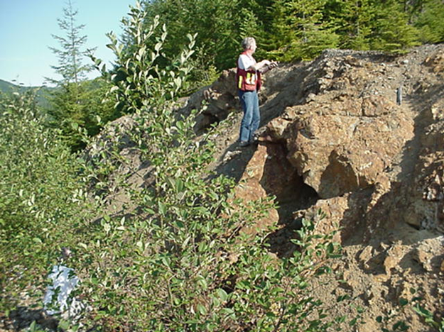
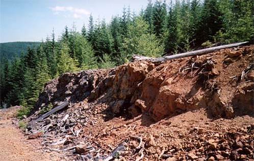
The Highly Visible mineralized showings on the Jasper claims lie in a rugged forested area accessible by logging roads. The item of significance which set the claim area apart is that, when cuts were being made for the logging roads, significant showings of copper sulfide mineralized rocks occurred.. Also, magnetic inversion established low susceptibility bodies coincident with polymetallic MINFILE occurrences surrounded by narrow, vertical high susceptibility pipes. Electromagnetic inversion established a 2 layer resistivity model - thick high resistivity layer from surface to 300-600 m. depth overlying a thin, sub-horizontal to undulating low resistivity (high conductivity) layer.
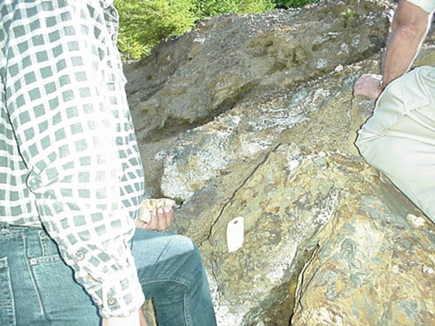
The Jasper Main Grid area is underlain by apparently conformable lithological horizons including an eastern felsic volcanic (dacite or rhyodacite) horizon and a western mafic volcanic (basalt) horizon separated by a central intermediate volcanic horizon. Lithological contacts strike N-S and are offset by cross faults which strike NW-SE. Fifteen polymetallic sulphide zones have been discovered in outcrop over a 2.75 km. strike length within the Main Grid area. Select outcrop sampling of these zones has yielded values up to 20% Lead, 25% Zinc, 15% Copper, 61 g/t Silver and 0.21 g/t Gold from separate samples taken from different zones. A 2.25 km. length by 0.5 km wide polymetallic soil geochemistry anomaly is coincident with the area of polymetallic zones, and roughly coincident with the central intermediate volcanic horizon. The Jasper Property is hosted in a belt of rocks mapped as upper Triassic to lower Jurassic Bonanza group. The belt trends southeasterly from Nitinat Lake through Gordon River, south of Cowichan Lake. The Bonanza belt is flanked to the west and east by Paleozoic Sicker Group rocks which host the economically important Myra Falls Massive Sulphide district located approximately 120 kilometres to the northwest, and the Lara Massive Sulphide district located approximately 50 kilometres to the east. A north trending gossanous alteration zone with a strike length greater than four kilometers underlies the Jasper Property from Caycuse Creek in the south to the Nitinat River in the north. The alteration zone is characterized by argillization, silicification and pervasive pyrite flooding. The alteration zone is generally concordant with the foliation and stratigraphy throughout its strike length. The Jasper Main Grid area is partially underlain by the intense alteration zone. Modeling and 3-D inversion of the 2008 airborne magnetic and electromagnetic data was completed for a portion of the Jasper Property during late 2017. Magnetic inversion established low susceptibility bodies coincident with polymetallic zones surrounded by narrow, vertical high susceptibility pipes. Preliminary electromagnetic inversion established a 2 Layer resistivity model consisting of a thick high resistivity layer from surface to 300-600 m. depth overlying a thin, sub-horizontal to undulating low resistivity (high conductivity) layer. The deep high conductivity layer could represent a sedimentary, replacement, epithermal or metallic sulphide horizon, and has never been tested by drilling.
Historical & Grades
Previous work done on the property included soil and rock sampling, geological mapping, drilling and limited geophysical work. This work confirmed the presence of lower Jurassic Bonanza Group, which comprises predominantly tuffaceous volcanic rocks.
Mineralization discovered in outcrop over a 2.5 by 0.5 km area on the property consists of 15 sulphide zones. The results include:
- Outcrop sampling included: zinc: 0.01% to 15.00%, copper: 0.09% to 8.38%, lead: 0.01% to 20.07%, gold: 0.019 g/t to 0.214 g/t and silver: 3.04g/t to 61.45g/t
- Drilling results showed zinc: 0.146% to 11.570%, copper: 0.011% to 0.871%, lead: 0.003% to 6.330%, gold 0,006g/t to 0,05g/t and silver: 2.50g/t to 61.45g/t
The model given at the time was hydrothermally remobilized base metal mineralization related to either one of the following:
- Polymetallic Veins Ag-Pb-Zn+/-Au.
- Epithermal Au-Ag-Cu High Sulphidation.
- Cu+/-Ag Quartz Veins.
- Noranda/ Kuroko massive Cu-Pb-Zn.
- Porphyry Cu-Mo-Au.
Either one of this type of geological settings may point to geological occurrences conducive to mineralization worthy of evaluation, by way of a drill program. Considerable technical re-evaluation is currently underway to take the geophysical interpretations into consideration. The results will be released once available.